Satellites · where they are now
Every working satellite in orbit
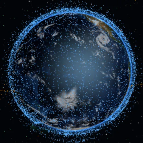
Around sixteen thousand satellites are up and working, most of them in low Earth orbit, under 2,000 km from the ground. Exo-View shows each as a dot where it is now, coloured by how high its orbit goes, and lets you click one for its height, speed, owner and launch date. Checked October 2026.
- Working satellites
- About 15,900, from CelesTrak's list of the satellites that are active
- Highest ordinary orbit
- Geostationary: 35,786 km above the equator
- How their places are found
- Worked out in your browser from NORAD's orbital elements, with the owner and launch date from CelesTrak's satellite catalogue
| Orbit | Height | One lap | Colour | Used for |
|---|---|---|---|---|
| Low Earth | Up to 2,000 km | About 90–130 minutes | Blue | Imaging, broadband constellations such as Starlink, and the Space Station |
| Medium Earth | 2,000 to about 34,000 km | Hours | Green | Navigation: GPS circles twice a day, 20,200 km up |
| Geostationary | About 35,786 km, over the equator | One day, in step with the Earth | Amber | Weather and television: each hangs over one spot |
| Elliptical | Swings from near the Earth to far out | Often half a day | Orange | Reaching high latitudes, as in the Molniya orbit |
Exo-View sorts each satellite by the size and shape of its orbit: a stretched, oval orbit is elliptical whatever its height.
What the dots are
Every dot is a satellite that is up and working: not debris, not spent rocket stages, and nothing that is missing from the public catalogue. A large share belong to a few constellations, Starlink above all, which is why low Earth orbit looks like a swarm while the geostationary ring, with only a few hundred satellites, looks like a thin necklace.
How their places are worked out
Each satellite is described by nine numbers — the size, shape, tilt and timing of its orbit — taken from NORAD's public elements as CelesTrak distributes them. Your browser works out from them where each one is now. The file (about 1.8 MB) comes from this site, and only when you switch the layer on.
The elements age. They are good for about two weeks, and satellites manoeuvre, Starlink constantly, so the places are approximate and a satellite's plate warns when its elements are old.
The shells and the ring
Zoom out and the shape of it appears: the dense blue shell of low Earth orbit, the green layer of navigation satellites above it, and far out over the equator the amber ring of geostationary ones. Exo-View draws what lies beyond 8,000 km nearer the Earth than it is, so the ring comes out closer than its true 35,786 km.
In Exo-View
The key below opens the globe with Satellites switched on. Click a dot for its height, speed, orbit and owner, and fly in to a model of it. Up close every satellite is drawn with the same general model, so a Starlink and a GPS satellite look alike.
See the satellites in 3D